Which features and mapping tools can be used to improve delivery zones and route planning
We have sourced and developed dozens of maps for the UK, Europe, USA and others. We have larger postcode area maps (e.g. YO) for nationwide planning or we have super detailed postcode sectors (e.g. YO18 8) that will split inner cities into manageable delivery zones.
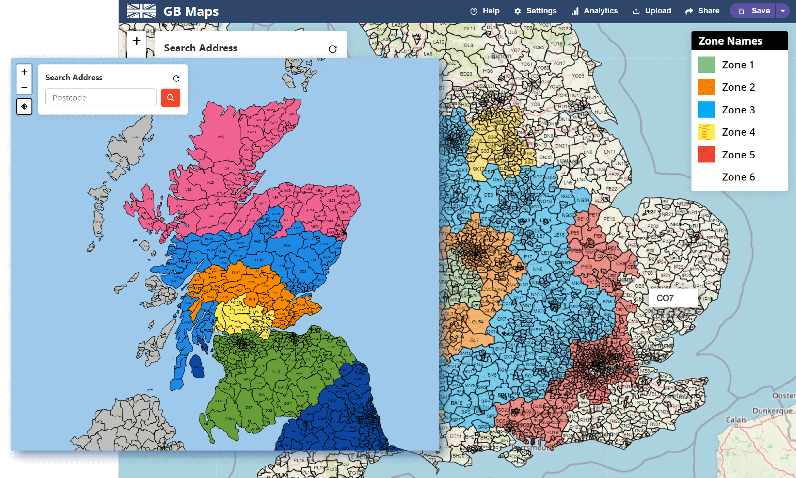
Delivery companies of any size can take advantage of these interactive mapping tools. A national furniture delivery store can split the country into evenly sized zones for delivery people, whereas a local Indian takeaway can map their delivery prices over their town or city.

You can use the advanced WebMaps mapping tool to display polygons, circles and drivetime polygons.
Drivetime polygons, also known as isochrones, show how far you can travel in every direction by road in a certain amount of time. Isochrones are specifically useful in cities like Newcastle or London where the river hinders progress in some directions.
Delivery companies, such as a pizza shop, that charge by how far their delivery driver needs to travel will find the concentric drivetime polygons invaluable. Once added, every postcode search will output which zone it's located in and the corresponding price.
Many companies report saving money and increasing sales by accurately charging their customers the correct delivery price.
Every delivery company will work differently. That's why we allow you to upload thousands of markers to your map. You can show your customers in one colour, delivery drivers in another and your warehouses in another. Our simple markers and marker key will quickly show you how your delivery setup is working across the country.
Many of our clients use these markers to analyze the locations of their salespeople and warehouses. Using the map can easily see which areas need further coverage and which are too tightly packed.

When running a delivery company it's essential that you can find prices quickly and easily when talking to a potential customer. That's why our postcode search will not only show you it's exact location; it will also show the coloured zone it's in, the drivetime zone it's in and the closest marker to that location.
Using this bulk of information you can quickly identify the closest delivery driver, the price the customer will have to pay and much more.
Using the combine polygons feature you can select multiple polygons from the background map and combine them together. This will show one solid polygon on the map in a different colour to the background map.
This feature is great for planning delivery zones for different delivery drivers. You can compare the the zone sizes and whether one overlaps another with ease.
To make sure you can see each combined polygon there is also a feature to alter the offset of each polygon individually.

We're happy to help with any questions or requests you have. Feel free to get in touch at any time.
Read through our FAQ's page. We've answered a lot of mapping questions.
Learn more about the history of gbmaps.com and this tool.
