We have been creating maps and mapping software for many years. Throughout that time we've had some tools that became popular and evolved into really useful little projects.
To give people an idea of the types of projects we can create we have listed some of them below. Some projects are live and can be used today. Others will just have a writeup as they are being used and can't be totally released to the public.
If you have any questions or enquiries please get in touch today. We're a small company and pride ourselves on getting replying within an hour.
You can already add thousands of markers to your map. You will be able to select or list your locations, click go and receive a fully optimised route around all your locations. Multiple delivery drivers, shifts, breaks are all possible. You'll also be able to create detailed standard routes. These routes will come with accurate drive times and distances so you can plan your day accurately.
In many situations it's important that you have an accurate list of postcodes for a specific area. This could be for advertising, deliveries or sales areas. The UK now has over 1.7 million active postcodes and it's often just too difficult to create an accurate
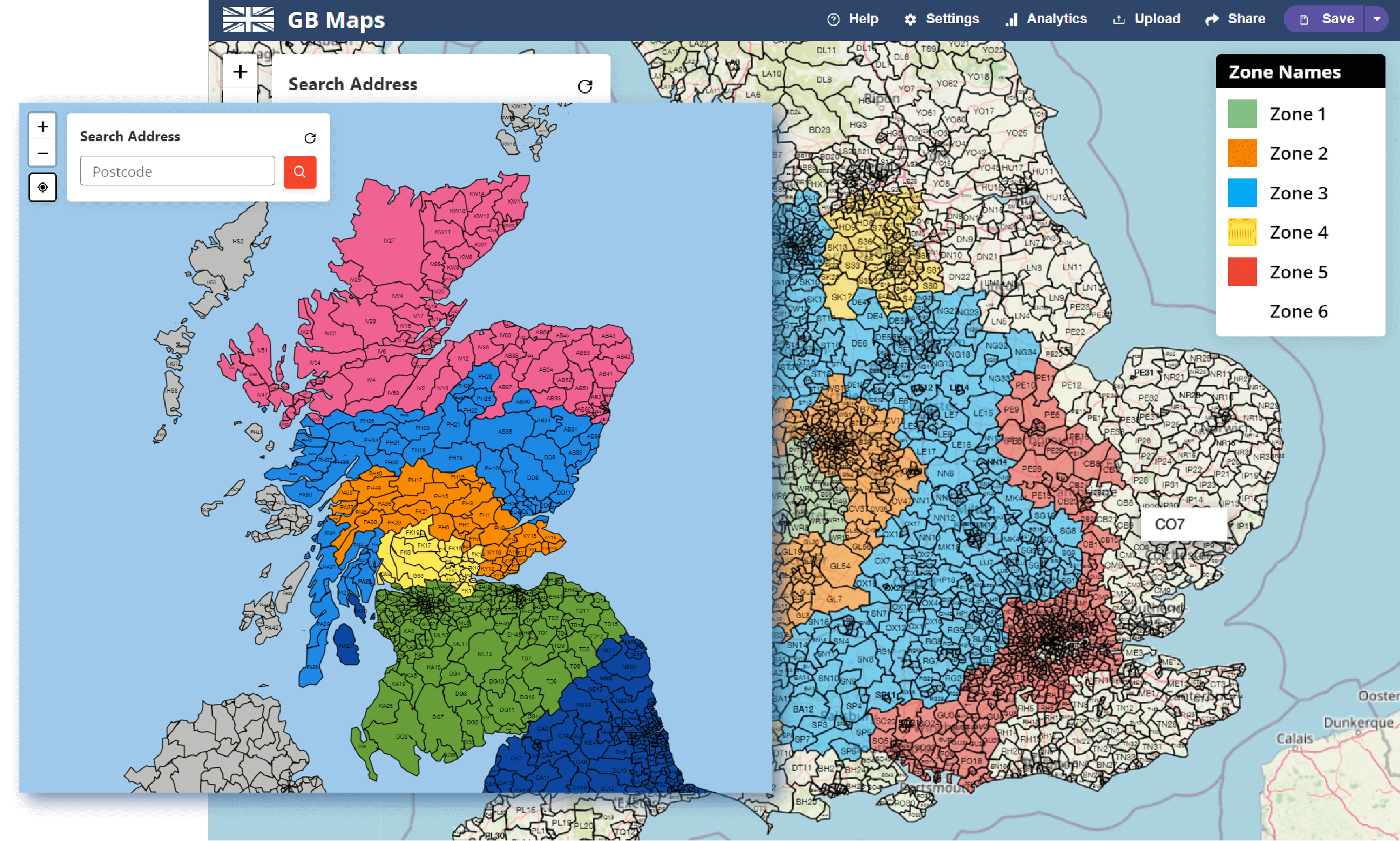
We have over a dozen basemaps to colour and use on our tools. Our plan is to release a feature to show or hide extra maps on top of your basemap. This is a popular request for NHS maps, allowing the user to quickly see how different boundaries relate to each other.
